
Sagaing Region
Region of Myanmar
Sagaing Region ▸ Facts ▸ Comments ▸ News ▸ Videos
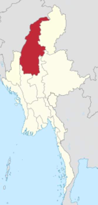
Sagaing Region is an administrative region of Myanmar, located in the north-western part of the country between latitude 21° 30' north and longitude 94° 97' east. It is bordered by Chin State and India's Nagaland, Manipur, and Arunachal Pradesh states to the west and north, Kachin State, Shan State, and Mandalay Region to the east and Mandalay Region and Magway Region to the south. The Ayeyarwady River forms a greater part of its eastern and also southern boundary. Sagaing Region has an area of 93,527 square kilometres (36,111 sq mi), making it the second-largest subdivision of Myanmar. In 1996, it had a population of over 5,300,000, while its population in 2012 was 6,600,000. The urban population 2012 was 1,230,000, and the rural population was 5,360,000. The namesake of Sagaing Region is Sagaing but the administrative capital and largest city is Monywa.
| 0 shares | ShareTweetSavePostSend |
You Might Like
Ulfa-I claims 3 'big' casualties in 'India drone strikes' on Myanmar camps, Army denies operationsUlfa-I claimed that three of its senior members were killed in drone attacks by the Indian Army in Myanmar's Sagaing region, but the Army has denied these claims. The outfit specified the attacks..IndiaTimes - Published |
| Search this site and the web: |