
Apalachicola Bay
Landform
Apalachicola Bay ▸ Facts ▸ Comments ▸ News ▸ Videos
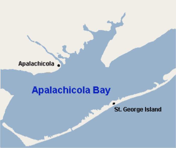
Apalachicola Bay is an estuary and lagoon located on the northwest coast of the U.S. state of Florida. The Apalachicola Bay system also includes St. George Sound, St. Vincent Sound and East Bay, covering an area of about 208 square miles (540 km2). Four islands, St. Vincent Island to the west, Cape St. George Island and St. George Island to the south, and Dog Island to the east, separate the system from the Gulf of Mexico. Water exchange occurs through Indian Pass, West Pass, East Pass and the Duer Channel. The lagoon has been designated as a National Estuarine Research Reserve and the Apalachicola River is the largest source of freshwater to the estuary. Combined with the Chattahoochee River, Flint River, and Ochlockonee River they drain a watershed of over 20,000 square miles (50,000 km2) at a rate of 19,599 cubic feet (550 m3) per second according to the United States Geological Survey in 2002.
| 0 shares | ShareTweetSavePostSend |
You Might Like
No news matches foundSorry, we were unable to find any results in our database for your queryFree news archive accessDid you know? You are eligible to search our news archive with millions of news references free of charge. To do this, please sign in first at the top of the screen. • Information about free access to our news archive Search this site and the web:  |