
A sinking feeling across Uttarakhand
 Sunday, 20 August 2023
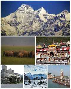
The Geological Survey of India says 72% of Uttarakhand – nearly 39,000 sq.km area – is landslideprone. Isro’s ‘Landslide Atlas of India’ also says Uttarakhand had the second highest number of landslides – 11,219 to Mizoram’s 12,385 – between 1988 and 2022. When it comes to districts, Rudraprayag and Tehri in Uttarakhand’s Garhwal region are the most landslide-prone in India. Tehri alone has 96 of the 333 landslideprone ‘danger zones’ identified in the state.
|
||||
|
|
||||
You Might Like💡 newsR Knowledge: Other News Mentions
|
||||

![LS Polls Phase 1 Polling: West Bengal records highest turnout as polling ends | Oneindia News [Video]](https://video.newsserve.net/300/v/20240419/1373174480-LS-Polls-Phase-Polling-West-Bengal-records.jpg)
![Sixth Schedule of Indian Constitution Explained: Sonam Wangchuk's Demand for Ladakh | Oneindia News [Video]](https://video.newsserve.net/300/v/20240329/1371259570-Sixth-Schedule-of-Indian-Constitution-Explained-Sonam-Wangchuk.jpg)


Losses due to floods: Himachal Pradesh CM questions silence of all four state MPsChief minister Sukhvinder Singh Sukhu on Friday created a flutter in state politics by attacking all four elected MPs from Himachal Pradesh including state...IndiaTimes |
United States: New York State Department Of Labor Releases Updated NYS WARN Act Regulations - Proskauer Rose LLPThe New York State Department of Labor ("NYS DOL") issued updated regulations under the New York State Worker Adjustment and Retraining Notification (WARN) Act...Mondaq |
Rajasthan is ‘rape capital’ of India, allege BJP's women MPs from stateTwo women Lok Sabha MPs from Rajasthan Ranjeeta Koli and Diya Kumari on Thursday alleged that the state has become the 'rape capital' of the country under Ashok...IndiaTimes |